
Thank you for supporting this site ❤️
Make a donation
Make a donation
Toledo topographic map
Click on the map to display elevation.
Thank you for supporting this site ❤️
Make a donation
Make a donation
About this map
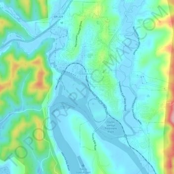
Name: Toledo topographic map, elevation, terrain.
Location: Toledo, Lincoln County, Oregon, 97391, United States (44.59906 -123.95459 44.63829 -123.91294)
Average elevation: 37 m
Minimum elevation: -5 m
Maximum elevation: 181 m
Thank you for supporting this site ❤️
Make a donation
Make a donation
Other topographic maps
Click on a map to view its topography, its elevation and its terrain.
Seal Rock State Recreation Site
United States > Oregon > Lincoln County > Seal Rock
Average elevation: 16 m
Thank you for supporting this site ❤️
Make a donation
Make a donation
Thank you for supporting this site ❤️
Make a donation
Make a donation