
Tisbury topographic map
Interactive map
Click on the map to display elevation.
About this map
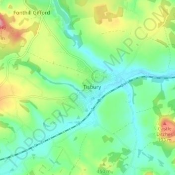
Name: Tisbury topographic map, elevation, terrain.
Location: Tisbury, Wiltshire, Zuidwest-Engeland, Engeland, SP3 6HU, VK (51.04400 -2.10303 51.08400 -2.06303)
Average elevation: 128 m
Minimum elevation: 86 m
Maximum elevation: 217 m