
Thank you for supporting this site ❤️
Make a donation
Make a donation
Glen Helen topographic map
Click on the map to display elevation.
Thank you for supporting this site ❤️
Make a donation
Make a donation
About this map
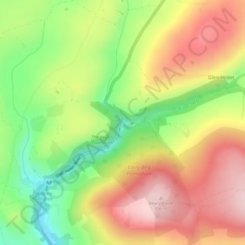
Name: Glen Helen topographic map, elevation, terrain.
Location: Glen Helen, German, Glenfaba, Isle of Man (54.21574 -4.62681 54.23574 -4.60681)
Average elevation: 185 m
Minimum elevation: 57 m
Maximum elevation: 303 m
Thank you for supporting this site ❤️
Make a donation
Make a donation