
Cisco Grove topographic map
Interactive map
Click on the map to display elevation.
About this map
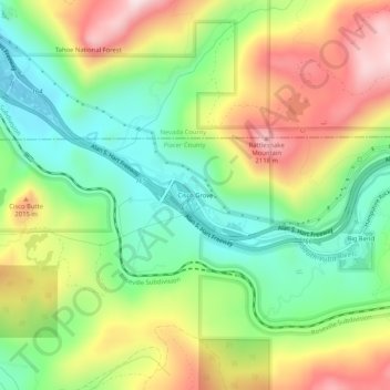
Name: Cisco Grove topographic map, elevation, terrain.
Location: Cisco Grove, Placer County, California, 95278, USA (39.28990 -120.55993 39.32990 -120.51993)
Average elevation: 1,882 m
Minimum elevation: 1,685 m
Maximum elevation: 2,152 m