
Thank you for supporting this site ❤️
Make a donation
Make a donation
Makanda topographic map
Click on the map to display elevation.
Thank you for supporting this site ❤️
Make a donation
Make a donation
About this map
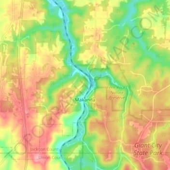
Name: Makanda topographic map, elevation, terrain.
Location: Makanda, Jackson County, Illinois, United States (37.59849 -89.26855 37.64583 -89.20016)
Average elevation: 178 m
Minimum elevation: 123 m
Maximum elevation: 227 m
Thank you for supporting this site ❤️
Make a donation
Make a donation
Other topographic maps
Click on a map to view its topography, its elevation and its terrain.