
Thank you for supporting this site ❤️
Make a donation
Make a donation
Amarpur topographic map
Click on the map to display elevation.
Thank you for supporting this site ❤️
Make a donation
Make a donation
Amarpur
Amarpur is located at 23°32′N 91°38′E / 23.53°N 91.64°E / 23.53; 91.64. It has an average elevation of 24 metres (78 feet) above sea level. The town is connected to Udaipur and Teliamura with metalled roads. It can be accessed from the capital city of Agartala via Udaipur town. The nearest airport is the Agartala Airport and the nearest railway station is Udaipur.
Thank you for supporting this site ❤️
Make a donation
Make a donation
About this map
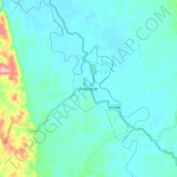
Name: Amarpur topographic map, elevation, terrain.
Location: Amarpur, Amarpur Urban, Gomati, Tripura, 799101, India (23.47550 91.61486 23.55550 91.69486)
Average elevation: 54 m
Minimum elevation: 27 m
Maximum elevation: 197 m
Thank you for supporting this site ❤️
Make a donation
Make a donation