
习酒镇 topographic map
Interactive map
Click on the map to display elevation.
About this map
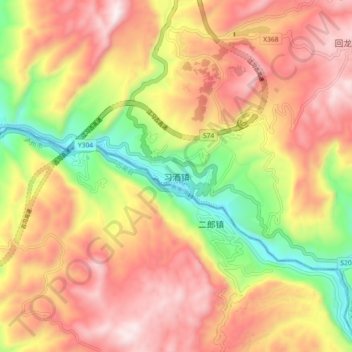
Name: 习酒镇 topographic map, elevation, terrain.
Location: 习酒镇, Zunyi, Guizhou, Chine (28.11948 106.12195 28.19948 106.20195)
Average elevation: 776 m
Minimum elevation: 313 m
Maximum elevation: 1,156 m