
Thank you for supporting this site ❤️
Make a donation
Make a donation
Peseux topographic map
Click on the map to display elevation.
Thank you for supporting this site ❤️
Make a donation
Make a donation
About this map
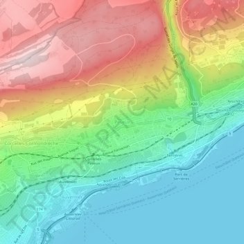
Name: Peseux topographic map, elevation, terrain.
Location: Peseux, Neuchâtel, 2034, Suisse (46.96869 6.87069 47.00869 6.91069)
Average elevation: 589 m
Minimum elevation: 422 m
Maximum elevation: 841 m
Thank you for supporting this site ❤️
Make a donation
Make a donation
Other topographic maps
Click on a map to view its topography, its elevation and its terrain.