
Lom-et-Djérem topographic map
Interactive map
Click on the map to display elevation.
About this map
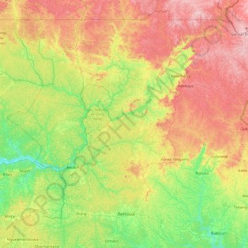
Name: Lom-et-Djérem topographic map, elevation, terrain.
Location: Lom-et-Djérem, Est, Cameroun (4.34053 12.80808 6.12910 14.62987)
Average elevation: 746 m
Minimum elevation: 579 m
Maximum elevation: 1,079 m
Other topographic maps
Click on a map to view its topography, its elevation and its terrain.