
Thank you for supporting this site ❤️
Make a donation
Make a donation
Onsala topographic map
Click on the map to display elevation.
Thank you for supporting this site ❤️
Make a donation
Make a donation
About this map
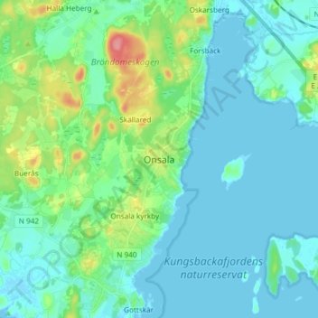
Name: Onsala topographic map, elevation, terrain.
Location: Onsala, Kungsbacka kommun, Halland County, 439 32, Sweden (57.38722 11.99027 57.46722 12.07027)
Average elevation: 15 m
Minimum elevation: -2 m
Maximum elevation: 79 m
Thank you for supporting this site ❤️
Make a donation
Make a donation
Other topographic maps
Click on a map to view its topography, its elevation and its terrain.