
Sint-Denijs topographic map
Interactive map
Click on the map to display elevation.
About this map
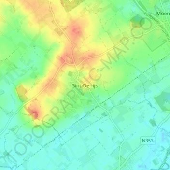
Name: Sint-Denijs topographic map, elevation, terrain.
Location: Sint-Denijs, Kortrijk, West-Vlaanderen, Vlaanderen, 8554, België (50.73171 3.34839 50.77171 3.38839)
Average elevation: 25 m
Minimum elevation: 9 m
Maximum elevation: 52 m