
Thank you for supporting this site ❤️
Make a donation
Make a donation
Ryker topographic map
Click on the map to display elevation.
Thank you for supporting this site ❤️
Make a donation
Make a donation
About this map
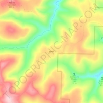
Name: Ryker topographic map, elevation, terrain.
Location: Ryker, Newton County, Arkansas, United States (35.86813 -93.49352 35.90813 -93.45352)
Average elevation: 641 m
Minimum elevation: 503 m
Maximum elevation: 756 m
Thank you for supporting this site ❤️
Make a donation
Make a donation
Other topographic maps
Click on a map to view its topography, its elevation and its terrain.