
Thank you for supporting this site ❤️
Make a donation
Make a donation
Zaria topographic map
Click on the map to display elevation.
Thank you for supporting this site ❤️
Make a donation
Make a donation
About this map
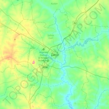
Name: Zaria topographic map, elevation, terrain.
Location: Zaria, Chikaji, Sabon Gari, Kaduna State, Nigeria (10.95349 7.55884 11.27349 7.87884)
Average elevation: 655 m
Minimum elevation: 606 m
Maximum elevation: 800 m
Thank you for supporting this site ❤️
Make a donation
Make a donation
Other topographic maps
Click on a map to view its topography, its elevation and its terrain.