
Thank you for supporting this site ❤️
Make a donation
Make a donation
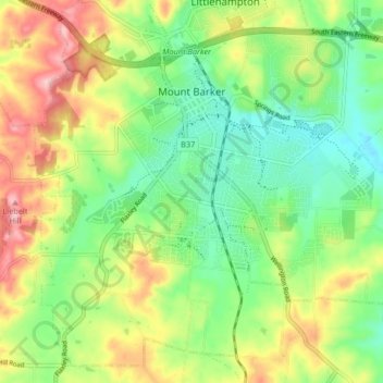
Mount Barker topographic map
Click on the map to display elevation.
Thank you for supporting this site ❤️
Make a donation
Make a donation
Mount Barker
Mount Barker is located on the plains surrounding the Mount Barker Summit, about 2 km west of the mountain, at 35°04′S 138°51′E / 35.067°S 138.850°E / -35.067; 138.850. Mount Barker is south east of Mount Lofty and Adelaide. It is north of The Coorong, and the west of Murray Bridge. Mount Barker is at an elevation of 360 m.
Thank you for supporting this site ❤️
Make a donation
Make a donation
About this map
Name: Mount Barker topographic map, elevation, terrain.
Average elevation: 368 m
Minimum elevation: 302 m
Maximum elevation: 467 m
Thank you for supporting this site ❤️
Make a donation
Make a donation