
Thank you for supporting this site ❤️
Make a donation
Make a donation
Mojoreno topographic map
Click on the map to display elevation.
Thank you for supporting this site ❤️
Make a donation
Make a donation
About this map
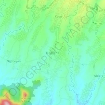
Name: Mojoreno topographic map, elevation, terrain.
Location: Mojoreno, Wonogiri, Central Java, Java, 57682, Indonesia (-7.86623 111.03928 -7.82623 111.07928)
Average elevation: 277 m
Minimum elevation: 215 m
Maximum elevation: 452 m
Thank you for supporting this site ❤️
Make a donation
Make a donation
Other topographic maps
Click on a map to view its topography, its elevation and its terrain.