
Altmünster topographic map
Interactive map
Click on the map to display elevation.
About this map
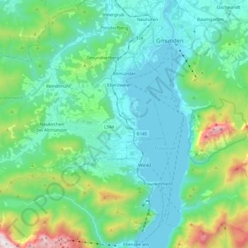
Name: Altmünster topographic map, elevation, terrain.
Location: Altmünster, Bezirk Gmunden, 4813, Oostenrijk (47.82369 13.60599 47.92740 13.79605)
Average elevation: 698 m
Minimum elevation: 414 m
Maximum elevation: 1,793 m