
Bocholt topographic map
Interactive map
Click on the map to display elevation.
About this map
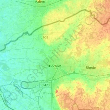
Name: Bocholt topographic map, elevation, terrain.
Location: Bocholt, Kreis Borken, Noordrijn-Westfalen, Duitsland (51.78982 6.47251 51.91759 6.72119)
Average elevation: 31 m
Minimum elevation: 16 m
Maximum elevation: 60 m
Other topographic maps
Click on a map to view its topography, its elevation and its terrain.
Raesfeld
Duitsland > Noordrijn-Westfalen > Kreis Borken
Raesfeld, Kreis Borken, Noordrijn-Westfalen, 46348, Duitsland
Average elevation: 54 m
Ahaus
Duitsland > Noordrijn-Westfalen > Kreis Borken
Ahaus, Kreis Borken, Noordrijn-Westfalen, 48683, Duitsland
Average elevation: 53 m
Borken
Duitsland > Noordrijn-Westfalen > Kreis Borken
Borken, Kreis Borken, Noordrijn-Westfalen, 46325, Duitsland
Average elevation: 56 m