
Thank you for supporting this site ❤️
Make a donation
Make a donation
Mollens (VD) topographic map
Click on the map to display elevation.
Thank you for supporting this site ❤️
Make a donation
Make a donation
About this map
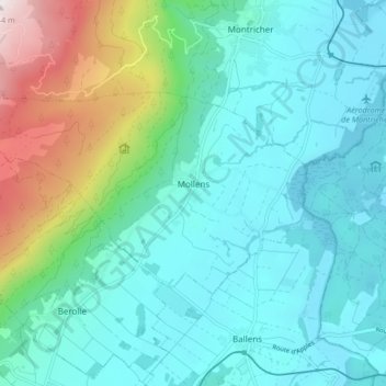
Name: Mollens (VD) topographic map, elevation, terrain.
Location: Mollens (VD), District de Morges, Vaud, 5431, Suisse (46.56093 6.30611 46.59090 6.38930)
Average elevation: 861 m
Minimum elevation: 654 m
Maximum elevation: 1,638 m
Thank you for supporting this site ❤️
Make a donation
Make a donation
Other topographic maps
Click on a map to view its topography, its elevation and its terrain.