
광산구 topographic map
Interactive map
Click on the map to display elevation.
About this map
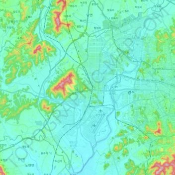
Name: 광산구 topographic map, elevation, terrain.
Location: 광산구, Gwangju, Corée du Sud (35.06992 126.64445 35.25888 126.86037)
Average elevation: 52 m
Minimum elevation: 2 m
Maximum elevation: 330 m
Other topographic maps
Click on a map to view its topography, its elevation and its terrain.