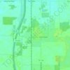
Click on the map to display elevation.
Name: Sugar Ridge topographic map, elevation, terrain.
Location: Sugar Ridge, Center Township, Wood County, Ohio, 43414, United States (41.40894 -83.64243 41.44894 -83.60243)
Average elevation: 203 m
Minimum elevation: 198 m
Maximum elevation: 208 m
Click on a map to view its topography, its elevation and its terrain.
United States > Ohio > Wood County
Average elevation: 190 m
Average elevation: 201 m
Average elevation: 207 m
Average elevation: 211 m
Average elevation: 194 m
Average elevation: 188 m
Average elevation: 214 m
Average elevation: 191 m
Average elevation: 200 m
United States > Ohio > Wood County > Otsego