
Gallatin National Forest topographic map
Interactive map
Click on the map to display elevation.
About this map
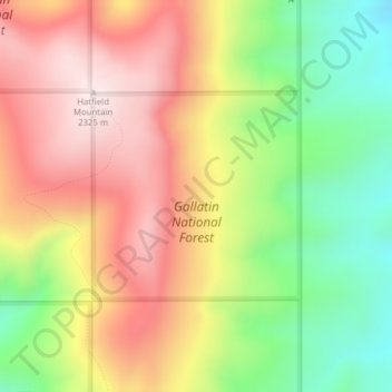
Name: Gallatin National Forest topographic map, elevation, terrain.
Average elevation: 2,064 m
Minimum elevation: 1,785 m
Maximum elevation: 2,326 m
Other topographic maps
Click on a map to view its topography, its elevation and its terrain.
Big Sky
United States > Montana > Gallatin County
Big Sky, Gallatin County, Montana, United States
Average elevation: 2,435 m
West Yellowstone
United States > Montana > Gallatin County
West Yellowstone, Gallatin County, Montana, United States
Average elevation: 2,034 m
Bozeman
United States > Montana > Gallatin County
Bozeman, Gallatin County, Montana, United States
Average elevation: 1,495 m
Logan
United States > Montana > Gallatin County
Logan, Gallatin County, Montana, United States
Average elevation: 1,294 m
Clarkston
United States > Montana > Gallatin County
Clarkston, Gallatin County, Montana, United States
Average elevation: 1,236 m
Gallatin River
United States > Montana > Gallatin County
Gallatin River, Gallatin Gateway, Gallatin County, Montana, United States
Average elevation: 1,509 m
Manhattan
United States > Montana > Gallatin County
Manhattan, Gallatin County, Montana, United States
Average elevation: 1,294 m
Three Forks
United States > Montana > Gallatin County
Three Forks, Gallatin County, Montana, United States
Average elevation: 1,249 m
Four Corners
United States > Montana > Gallatin County
Four Corners, Gallatin County, Montana, United States
Average elevation: 1,469 m
Bozeman
United States > Montana > Gallatin County > Bozeman
Bozeman, Gallatin County, Montana, 59715, United States
Average elevation: 1,679 m
Big Sky Canyon Village
United States > Montana > Gallatin County > Big Sky Canyon Village
Big Sky Canyon Village, Gallatin County, Montana, United States
Average elevation: 1,994 m
Belgrade
United States > Montana > Gallatin County
Belgrade, Gallatin County, Montana, 59714, United States
Average elevation: 1,355 m