
Thank you for supporting this site ❤️
Make a donation
Make a donation
Nadur topographic map
Click on the map to display elevation.
Thank you for supporting this site ❤️
Make a donation
Make a donation
About this map
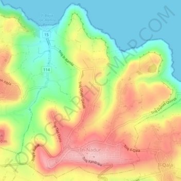
Name: Nadur topographic map, elevation, terrain.
Location: Nadur, Gozo Region, NDR 1011, Malta (36.03389 14.27726 36.06572 14.31805)
Average elevation: 76 m
Minimum elevation: 0 m
Maximum elevation: 161 m
Thank you for supporting this site ❤️
Make a donation
Make a donation