
Thank you for supporting this site ❤️
Make a donation
Make a donation
San Giorgio topographic map
Click on the map to display elevation.
Thank you for supporting this site ❤️
Make a donation
Make a donation
About this map
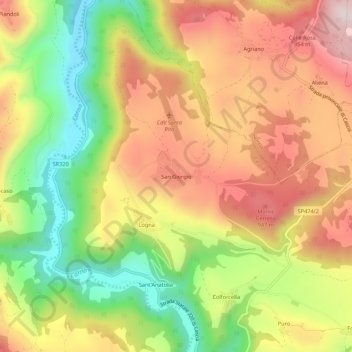
Name: San Giorgio topographic map, elevation, terrain.
Location: San Giorgio, Cascia, Perugia, Umbria, 06043, Italy (42.72952 12.99741 42.76952 13.03741)
Average elevation: 786 m
Minimum elevation: 524 m
Maximum elevation: 1,030 m
Thank you for supporting this site ❤️
Make a donation
Make a donation