
Thank you for supporting this site ❤️
Make a donation
Make a donation
Colle Terelle topographic map
Click on the map to display elevation.
Thank you for supporting this site ❤️
Make a donation
Make a donation
About this map
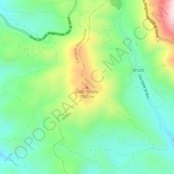
Name: Colle Terelle topographic map, elevation, terrain.
Location: Colle Terelle, Alvito, Frosinone, Lazio, Italia (41.73326 13.72125 41.73336 13.72135)
Average elevation: 856 m
Minimum elevation: 680 m
Maximum elevation: 1,213 m
Thank you for supporting this site ❤️
Make a donation
Make a donation