
Make a donation
Chironico topographic map
Click on the map to display elevation.
Make a donation
Chironico
The municipality is located in the Leventina district, on the right slope of the mid-Leventina valley at an elevation of 786 meters (2,579 ft). The municipality stretches from the Ticino river at the Biaschina-Schlucht (elevation 450 m (1,480 ft)) up to the Pizzo Campo Tencia (3,072 m (10,079 ft)) in the upper Piumogna valley. The core of the settlement, is made up of the sections of Grumo and Nivo, the latter is the only one in the valley bottom. Above the village center, situated on steeply sloping rock terraces are the settlements of Cala, Doro, Olina, and Osadigo Chiesso. The mountain village of Gribbio has a road connection.
Make a donation
About this map
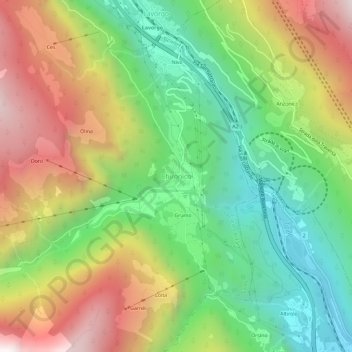
Name: Chironico topographic map, elevation, terrain.
Average elevation: 1,026 m
Minimum elevation: 391 m
Maximum elevation: 1,882 m
Make a donation
Other topographic maps
Click on a map to view its topography, its elevation and its terrain.