
Thank you for supporting this site ❤️
Make a donation
Make a donation
Kinderhook topographic map
Click on the map to display elevation.
Thank you for supporting this site ❤️
Make a donation
Make a donation
About this map
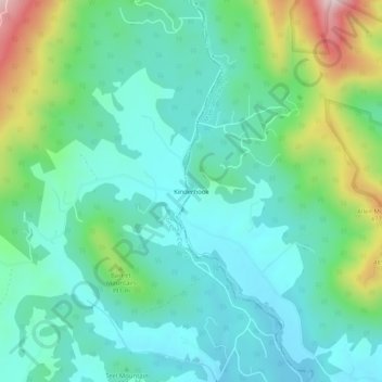
Name: Kinderhook topographic map, elevation, terrain.
Location: Kinderhook, Madison County, Virginia, 22723, United States (38.34985 -78.44806 38.38985 -78.40806)
Average elevation: 311 m
Minimum elevation: 201 m
Maximum elevation: 644 m
Thank you for supporting this site ❤️
Make a donation
Make a donation
Other topographic maps
Click on a map to view its topography, its elevation and its terrain.