
Make a donation
Medford Lakes topographic map
Click on the map to display elevation.
Make a donation
Medford Lakes
On July 12, 2004, the borough suffered substantial damage due to flooding, caused by 7.26 inches of rainfall over 14 hours. This led to the breaking of several dams, including the Quogue Dam and the Lower and Upper Aetna Lake Dams, causing water levels to rise beyond 500-year flood elevations on portions of Ballinger Run.
Make a donation
About this map
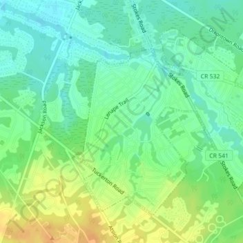
Name: Medford Lakes topographic map, elevation, terrain.
Location: Medford Lakes, Burlington County, New Jersey, United States (39.84757 -74.81949 39.86849 -74.78508)
Average elevation: 27 m
Minimum elevation: 14 m
Maximum elevation: 44 m
Make a donation
Other topographic maps
Click on a map to view its topography, its elevation and its terrain.
Franklin Park
United States > New Jersey > Burlington County > Willingboro Township
Average elevation: 11 m
Make a donation
Indian Mills
United States > New Jersey > Burlington County > Shamong Township
Average elevation: 25 m
Make a donation
Make a donation
Colemantown
United States > New Jersey > Burlington County > Mount Laurel Township
Average elevation: 20 m
Freedom Park
United States > New Jersey > Burlington County > Medford Township
Average elevation: 16 m
Make a donation
Coxs Corner
United States > New Jersey > Burlington County > Mount Laurel Township
Average elevation: 21 m
Make a donation
Burlington
United States > New Jersey > Burlington County > Burlington City > Burlington
Average elevation: 11 m
Make a donation
Make a donation
Chambers Corners
United States > New Jersey > Burlington County > Chambers Corners
Average elevation: 19 m
Garfield Park East
United States > New Jersey > Burlington County > Willingboro > Garfield Park East
Average elevation: 16 m
Apple Pie Hill Station Fire Tower
United States > New Jersey > Burlington County > Tabernacle Township
Average elevation: 34 m
Make a donation
Fellowship
United States > New Jersey > Burlington County > Mount Laurel Township
Average elevation: 16 m