
City of Niagara Falls topographic map
Interactive map
Click on the map to display elevation.
About this map
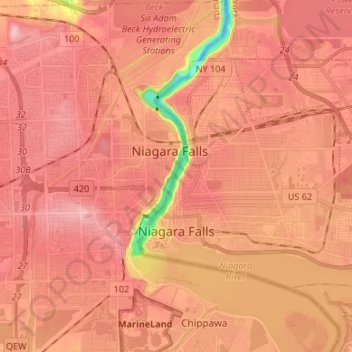
Name: City of Niagara Falls topographic map, elevation, terrain.
Average elevation: 180 m
Minimum elevation: 75 m
Maximum elevation: 220 m
Other topographic maps
Click on a map to view its topography, its elevation and its terrain.
Niagara Escarpment
États-Unis d'Amérique > New York > Niagara County > City of Lockport
Niagara Escarpment, City of Lockport, Town of Lockport, Niagara County, New York, États-Unis d'Amérique
Average elevation: 165 m