
Thank you for supporting this site ❤️
Make a donation
Make a donation
Riva di Solto topographic map
Click on the map to display elevation.
Thank you for supporting this site ❤️
Make a donation
Make a donation
About this map
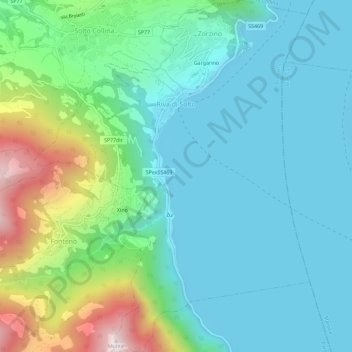
Name: Riva di Solto topographic map, elevation, terrain.
Location: Riva di Solto, Bergamo, Lombardy, 24060, Italy (45.74521 10.00522 45.78523 10.06036)
Average elevation: 386 m
Minimum elevation: 175 m
Maximum elevation: 1,090 m
Thank you for supporting this site ❤️
Make a donation
Make a donation