
Thank you for supporting this site ❤️
Make a donation
Make a donation
Custer Township topographic map
Click on the map to display elevation.
Thank you for supporting this site ❤️
Make a donation
Make a donation
About this map
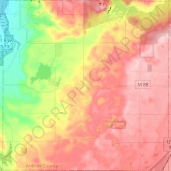
Name: Custer Township topographic map, elevation, terrain.
Location: Custer Township, Antrim County, Michigan, United States (44.85870 -85.21175 44.94614 -85.09134)
Average elevation: 285 m
Minimum elevation: 175 m
Maximum elevation: 360 m
Thank you for supporting this site ❤️
Make a donation
Make a donation
Other topographic maps
Click on a map to view its topography, its elevation and its terrain.