
Rhymney topographic map
Interactive map
Click on the map to display elevation.
About this map
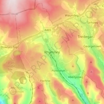
Name: Rhymney topographic map, elevation, terrain.
Location: Rhymney, Gwent, Wales, NP22, United Kingdom (51.72132 -3.32852 51.80132 -3.24852)
Average elevation: 375 m
Minimum elevation: 148 m
Maximum elevation: 566 m