
Saint-Vincent topographic map
Interactive map
Click on the map to display elevation.
About this map
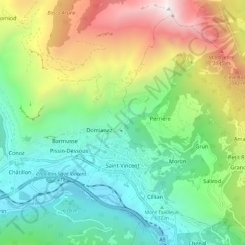
Name: Saint-Vincent topographic map, elevation, terrain.
Location: Saint-Vincent, Valle de Aosta, 11027, Italia (45.73476 7.63113 45.78668 7.71547)
Average elevation: 1,179 m
Minimum elevation: 411 m
Maximum elevation: 2,704 m