
东山县 topographic map
Interactive map
Click on the map to display elevation.
About this map
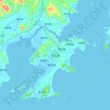
Name: 东山县 topographic map, elevation, terrain.
Location: 东山县, Zhangzhou, Fujian, China (23.54362 117.26484 23.86362 117.58484)
Average elevation: 17 m
Minimum elevation: -2 m
Maximum elevation: 489 m