
Ghatti topographic map
Click on the map to display elevation.
About this map
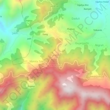
Name: Ghatti topographic map, elevation, terrain.
Location: Ghatti, Bhikiasain, Almora, Uttarakhand, 263646, India (29.58678 79.24361 29.62678 79.28361)
Average elevation: 1,463 m
Minimum elevation: 1,003 m
Maximum elevation: 1,957 m
Other topographic maps
Click on a map to view its topography, its elevation and its terrain.