
Thank you for supporting this site ❤️
Make a donation
Make a donation
Rue Caucherie topographic map
Click on the map to display elevation.
Thank you for supporting this site ❤️
Make a donation
Make a donation
About this map
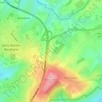
Name: Rue Caucherie topographic map, elevation, terrain.
Average elevation: 104 m
Minimum elevation: 45 m
Maximum elevation: 188 m
Thank you for supporting this site ❤️
Make a donation
Make a donation
Other topographic maps
Click on a map to view its topography, its elevation and its terrain.
Mont Lambert
France > Hauts-de-France > Pas-de-Calais > Saint-Martin-Boulogne
Average elevation: 101 m