
Thank you for supporting this site ❤️
Make a donation
Make a donation
Etoy topographic map
Click on the map to display elevation.
Thank you for supporting this site ❤️
Make a donation
Make a donation
About this map
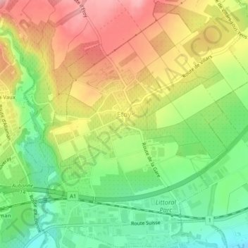
Name: Etoy topographic map, elevation, terrain.
Location: Etoy, District de Morges, Vaud, 1163, Suisse (46.47158 6.40360 46.49836 6.43954)
Average elevation: 442 m
Minimum elevation: 376 m
Maximum elevation: 512 m
Thank you for supporting this site ❤️
Make a donation
Make a donation
Other topographic maps
Click on a map to view its topography, its elevation and its terrain.