
Queen Elizabeth National Park topographic map
Interactive map
Click on the map to display elevation.
About this map
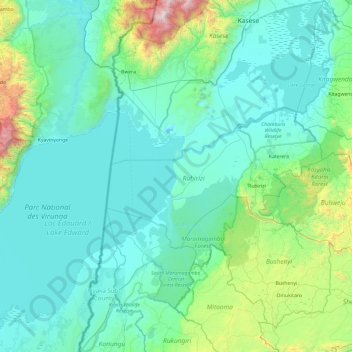
Name: Queen Elizabeth National Park topographic map, elevation, terrain.
Average elevation: 1,194 m
Minimum elevation: 880 m
Maximum elevation: 3,406 m
Other topographic maps
Click on a map to view its topography, its elevation and its terrain.
Bunyaruguru/Kichwambe Volcanic Field
Bunyaruguru/Kichwambe Volcanic Field, Rubirizi, Western Region, Ouganda
Average elevation: 1,169 m