Geolocate

Pekan Nanas topographic map

Interactive map

Click on the map to display elevation.

About this map

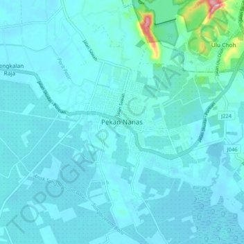
Name: Pekan Nanas topographic map, elevation, terrain.

Location: Pekan Nanas, Pontian, Johor, 81500, Malaysia (1.46676 103.47272 1.54676 103.55272)

Average elevation: 16 m

Minimum elevation: 1 m

Maximum elevation: 167 m

Other topographic maps

Click on a map to view its topography, its elevation and its terrain.

Kulai

Malaysia > Johor

Average elevation: 40 m

Tangkak

Malaysia > Johor

Average elevation: 48 m

Kota Tinggi

Malaysia > Johor

Average elevation: 29 m

Muar

Malaysia > Johor

Average elevation: 26 m

Pontian

Malaysia > Johor

Average elevation: 19 m

Pulau Juling

Malaysia > Johor > Pasir Gudang

Average elevation: 2 m

Iskandar Puteri

Malaysia > Johor > Iskandar Puteri

Average elevation: 28 m