
Puemba topographic map
Interactive map
Click on the map to display elevation.
About this map
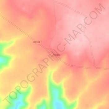
Name: Puemba topographic map, elevation, terrain.
Location: Puemba, Plateaux, Mai-Ndombe, Democratic Republic of the Congo (-3.22910 16.29714 -3.18910 16.33714)
Average elevation: 465 m
Minimum elevation: 329 m
Maximum elevation: 512 m
Other topographic maps
Click on a map to view its topography, its elevation and its terrain.
Plateaux
Democratic Republic of the Congo > Mai-Ndombe > Plateaux
Plateaux, Mai-Ndombe, 00243, Democratic Republic of the Congo
Average elevation: 421 m