
Thank you for supporting this site ❤️
Make a donation
Make a donation
Jumbo topographic map
Click on the map to display elevation.
Thank you for supporting this site ❤️
Make a donation
Make a donation
About this map
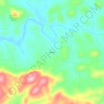
Name: Jumbo topographic map, elevation, terrain.
Location: Jumbo, Izard County, Arkansas, United States (36.04007 -91.99959 36.08007 -91.95959)
Average elevation: 184 m
Minimum elevation: 123 m
Maximum elevation: 314 m
Thank you for supporting this site ❤️
Make a donation
Make a donation
Other topographic maps
Click on a map to view its topography, its elevation and its terrain.