
Thank you for supporting this site ❤️
Make a donation
Make a donation
Egilsfjall topographic map
Click on the map to display elevation.
Thank you for supporting this site ❤️
Make a donation
Make a donation
About this map
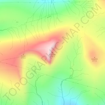
Name: Egilsfjall topographic map, elevation, terrain.
Location: Egilsfjall, Kvívík, Streymoyar sýsla, 340, Færøerne (62.13866 -7.08840 62.13876 -7.08830)
Average elevation: 353 m
Minimum elevation: 134 m
Maximum elevation: 613 m
Thank you for supporting this site ❤️
Make a donation
Make a donation