
Thank you for supporting this site ❤️
Make a donation
Make a donation
Nam Khene topographic map
Click on the map to display elevation.
Thank you for supporting this site ❤️
Make a donation
Make a donation
About this map
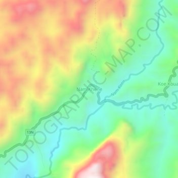
Name: Nam Khene topographic map, elevation, terrain.
Location: Nam Khene, Kasy District, Vientiane Province, Laos (19.31969 102.35729 19.35969 102.39729)
Average elevation: 807 m
Minimum elevation: 465 m
Maximum elevation: 1,319 m
Thank you for supporting this site ❤️
Make a donation
Make a donation
Other topographic maps
Click on a map to view its topography, its elevation and its terrain.