
Oberstammheim topographic map
Interactive map
Click on the map to display elevation.
About this map
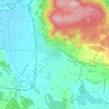
Name: Oberstammheim topographic map, elevation, terrain.
Location: Oberstammheim, Bezirk Andelfingen, Zurich, 8477, Suisse (47.61177 8.77860 47.65177 8.81860)
Average elevation: 485 m
Minimum elevation: 415 m
Maximum elevation: 644 m