
Thank you for supporting this site ❤️
Make a donation
Make a donation
Signèse (Ayent) topographic map
Click on the map to display elevation.
Thank you for supporting this site ❤️
Make a donation
Make a donation
About this map
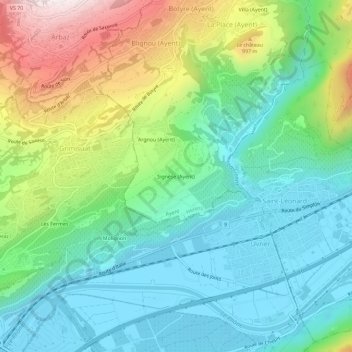
Name: Signèse (Ayent) topographic map, elevation, terrain.
Location: Signèse (Ayent), Ayent, Hérens, Valais, 1966, Suisse (46.23749 7.38248 46.27749 7.42248)
Average elevation: 718 m
Minimum elevation: 488 m
Maximum elevation: 1,252 m
Thank you for supporting this site ❤️
Make a donation
Make a donation