
Thank you for supporting this site ❤️
Make a donation
Make a donation
Bradford topographic map
Click on the map to display elevation.
Thank you for supporting this site ❤️
Make a donation
Make a donation
About this map
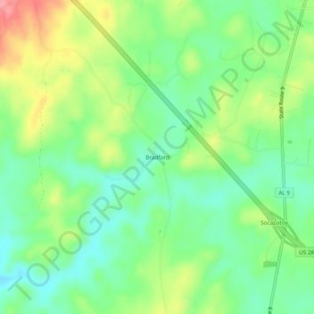
Name: Bradford topographic map, elevation, terrain.
Location: Bradford, Coosa County, Alabama, United States (32.97484 -86.10497 33.01484 -86.06497)
Average elevation: 219 m
Minimum elevation: 181 m
Maximum elevation: 283 m
Thank you for supporting this site ❤️
Make a donation
Make a donation