
Thank you for supporting this site ❤️
Make a donation
Make a donation
San Mateo topographic map
Click on the map to display elevation.
Thank you for supporting this site ❤️
Make a donation
Make a donation
About this map
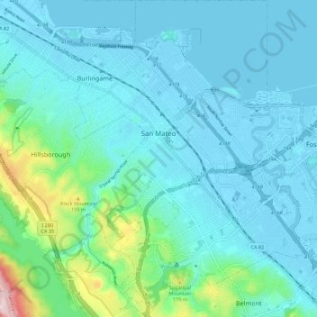
Name: San Mateo topographic map, elevation, terrain.
Location: San Mateo, San Mateo County, California, United States (37.51281 -122.35491 37.59939 -122.27459)
Average elevation: 48 m
Minimum elevation: -6 m
Maximum elevation: 333 m
Thank you for supporting this site ❤️
Make a donation
Make a donation