
Thank you for supporting this site ❤️
Make a donation
Make a donation
Svetoslav topographic map
Click on the map to display elevation.
Thank you for supporting this site ❤️
Make a donation
Make a donation
About this map
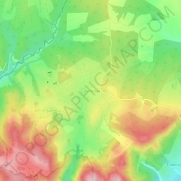
Name: Svetoslav topographic map, elevation, terrain.
Location: Svetoslav, Stambolovo, Haskovo, Bulgaria (41.63099 25.62404 41.67099 25.66404)
Average elevation: 338 m
Minimum elevation: 201 m
Maximum elevation: 492 m
Thank you for supporting this site ❤️
Make a donation
Make a donation
Other topographic maps
Click on a map to view its topography, its elevation and its terrain.