
Thank you for supporting this site ❤️
Make a donation
Make a donation
Oakhurst topographic map
Click on the map to display elevation.
Thank you for supporting this site ❤️
Make a donation
Make a donation
Oakhurst
According to the United States Census Bureau, the CDP had a total area of 1.614 square miles (4.178 km2), including 1.611 square miles (4.171 km2) of land and 0.003 square miles (0.006 km2) of water (0.16%). The CDP also has an elevation of 46 feet above sea level.
Thank you for supporting this site ❤️
Make a donation
Make a donation
About this map
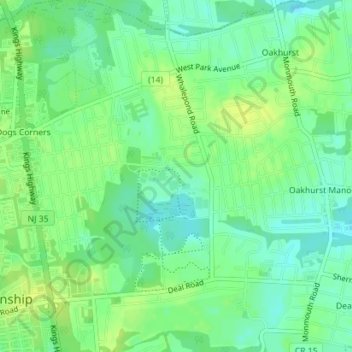
Name: Oakhurst topographic map, elevation, terrain.
Average elevation: 15 m
Minimum elevation: 6 m
Maximum elevation: 23 m
Thank you for supporting this site ❤️
Make a donation
Make a donation