
Kraśnik topographic map
Interactive map
Click on the map to display elevation.
About this map
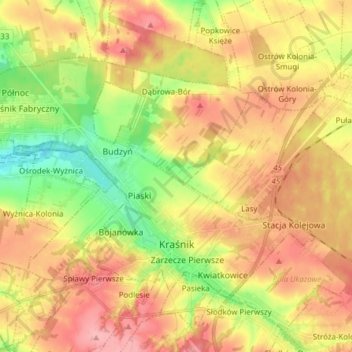
Name: Kraśnik topographic map, elevation, terrain.
Location: Kraśnik, Kraśnik County, Lublin Voivodeship, Poland (50.91061 22.13681 50.97629 22.29015)
Average elevation: 232 m
Minimum elevation: 179 m
Maximum elevation: 278 m
Other topographic maps
Click on a map to view its topography, its elevation and its terrain.
Kraśnik
Poland > Lublin Voivodeship > Kraśnik County > Popkowice
Kraśnik, Popkowice, gmina Urzędów, Kraśnik County, Lublin Voivodeship, Poland
Average elevation: 229 m