
Thank you for supporting this site ❤️
Make a donation
Make a donation
Challhuahuacho topographic map
Click on the map to display elevation.
Thank you for supporting this site ❤️
Make a donation
Make a donation
About this map
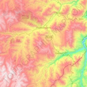
Name: Challhuahuacho topographic map, elevation, terrain.
Location: Challhuahuacho, Province of Cotabambas, Apurímac, Peru (-14.30396 -72.47976 -14.05243 -72.14408)
Average elevation: 4,040 m
Minimum elevation: 2,934 m
Maximum elevation: 4,889 m
Thank you for supporting this site ❤️
Make a donation
Make a donation
Other topographic maps
Click on a map to view its topography, its elevation and its terrain.
Thank you for supporting this site ❤️
Make a donation
Make a donation
Thank you for supporting this site ❤️
Make a donation
Make a donation
Thank you for supporting this site ❤️
Make a donation
Make a donation
Thank you for supporting this site ❤️
Make a donation
Make a donation
Thank you for supporting this site ❤️
Make a donation
Make a donation